
 Yahoo Finance
 Harsh frost set to hit parts of England, Met Office says
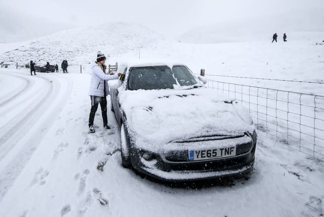
A “harsh frost” is set to grip parts of England amid more weather warnings for snow and ice.
The frost is set to form under clear skies in the north west on Sunday morning as some wintry showers could see icy patches in other regions, the Met Office said.
Early temperatures could fall to -1C in parts of Scotland and are not forecast to go above 4C for the rest of the nation, or most of England and Wales.
A harsh frost under the clear skies in the northwest this Sunday morning. Cloudier elsewhere with some wintry showers bringing the risk of icy patches#WeatherAware pic.twitter.com/LVHHXAgmbd
— Met Office (@metoffice) January 2, 2021
A yellow weather warning for snow and ice has been issued, which states that tricky travel conditions may be caused by icy patches and hill snow.
The warning, which runs to Sunday morning, covers Central, Tayside & Fife, the East Midlands, Grampian, north east and north west England, south west Scotland, Lothian Borders plus Yorkshire and Humber.
And some parts of the UK could be set for some wintry showers.
These maybe “mainly inland and particularly over higher ground where above 200-300m a further few centimetres of snow is possible in places”, the warning states.
The chill in the air is due to high pressure to the north of the UK, which is dragging air from the east “which at this time of year is cold”, the Met Office said.
The cold easterly winds are set to develop next week, bringing wintry showers – particularly around eastern parts – while hazardous freezing fog, frost and ice risks will all continue, the forecasters say.
Meteorologist Alex Burkill said: “Obviously it’s very cold and it’s going to stay cold through this week.
“Whilst there will be some wintry hazards around, it’s not really until the end of the week until we see any significant snow.”
RAC Breakdown spokesman Simon Williams said: “The message for those who have to drive is to adjust their speed according to the conditions and leave extra stopping distance so 2021 doesn’t begin with an unwelcome bump and an insurance claim.
“Snow and ice are by far the toughest driving conditions, so if they can be avoided that’s probably the best policy.”
