
 Yahoo Finance
 Parts of UK hit by heavy snowfall as forecasters warn of wet week ahead
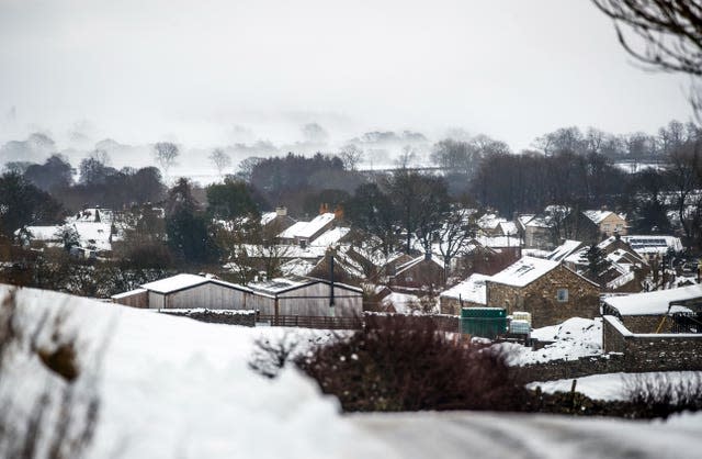
Parts of the UK saw between four and eight centimetres (1.5-3in) of snow to start the weekend, while forecasters are warning of heavy rainfall next week.
An amber weather alert for snow was in place for some areas on Saturday morning, with people told to expect travel delays, power cuts and a chance that rural communities could be “cut off”.
Those in East Anglia woke up to a thick layer of snow which had settled overnight, with the wintry downpours continuing into the afternoon.
As we go into next week, low pressure systems will move in from the Atlantic
Heavy and prolonged rainfall combined with #snow melt is likely to lead to #flooding in places
Stay #WeatherAware ⚠️ pic.twitter.com/l4vSMWEXmz
— Met Office (@metoffice) January 16, 2021
The Met Office officially recorded 4cm of snow in Norfolk, but estimated that this could have been closer to 8cm in other areas across eastern England.
Parts of north-east England and Scotland recorded 7cm (2.7in) of snow which had been lying on the ground from last week.
By the afternoon the worst of the wintry downpours had ended, with much of the UK expected to be clear and windy going into the evening.

But there were still 22 flood warnings across England, stretching from the South East to the North East, meaning “immediate action is required”, according to the Environment Agency.
Craig Snell, a Met Office forecaster, said: “Eastern England saw most of the snow on Saturday overnight, continuing into lunchtime, causing some difficulty for drivers as it turned to ice on the roads.
“Those in London and the South East who chose to have a lie-in would have missed the wintry downpours, though little dustings were seen in places just north of the capital.
“As the day progressed it became milder for many, clearing away the ice and snow and turning the day relatively bright.”
The lowest recorded temperature was in Northumberland, which saw a low of minus 5.4C overnight, while an area in Hampshire recorded a high of 11C during the afternoon.
On Sunday, southern and eastern parts of the UK will mostly see dry, sunny spells, Mr Snell said.
North-western regions are expected to see showers, with a “spell of more persistent rain” later on in the day.
But torrential downpours are set to move in from Monday, which could cause flooding.
The Met Office has issued a yellow rain warning for Monday evening, lasting until Wednesday.
The warning, which covers parts of north-west England and large swathes of Wales, says to expect heavy downpours with some snowmelt across hilly areas.
It said there could be a “danger to life” from possible “fast flowing or deep floodwater”, which could bring delays to public transport or damage to buildings.
Mr Snell added: “Around 30-60mm of rain could be seen in the worst affected regions, with 200mm in the most hilly areas.
“This could cause some snowmelt flooding issues, so people are advised to be very careful when travelling to work.”
