
 Yahoo Finance
 UK set to be battered by more heavy showers and high winds

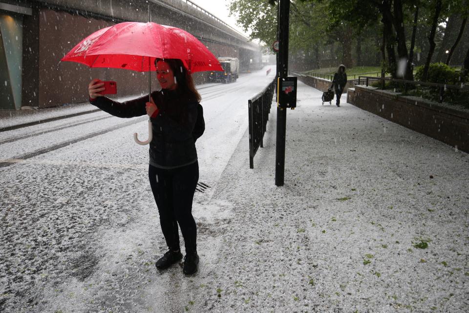
Hail fell on the streets of London
(PA Wire)Parts of the UK have been lashed with torrential rain and hail, with forecasters warning that more wet weather and high winds are expected later in the week.
Photographs showed hail falling so hard in the streets of London that the ground looked like it was covered in snow, while others parts of the South East were also hit with heavy rain.
The Met Office said that the country will continue to see showers through Wednesday, but on Thursday high winds and further rain could lead to weather warnings being imposed.
Met Office meteorologist Craig Snell said that the heaviest rain on Tuesday had fallen in the South East, with 16mm recorded over 12 hours in Goudhurst in Kent.
He added that a deep band of unseasonable low pressure will bring more wet and windy weather on Thursday and Friday, with some coastal areas likely to be hit with 60mph gusts.
Mr Snell said that the south-west of England and south Wales coast will see the strongest winds but inland there could still be gusts of 40-50mph which could cause some disruption.
He added: “We’re expecting in the South West and the south Wales coasts gusts reaching 60mph. Inland, potentially 40-50mph.
“This time of year, with the trees in full leaf, it could potentially bring some small branches down and because there’s a lot more outdoor furniture, we advise people that it is a bit vulnerable to strong winds and to tie it down.”
The heaviest rain will be in northern England, north Wales, Northern Ireland and southern Scotland, he added, with up to 70mm of rainfall on the high ground in Wales.
Mr Snell said that while no weather warnings were currently in force, the Met Office will keep a close watch on conditions.
A deep area of low pressure will arrive on our shores tomorrow night bringing strong winds and outbreaks of rain across the UK through Thursday and Friday.
Strongest winds are expected in the south-west 🌊💨
Heaviest rain is expected in the north-west ☔ pic.twitter.com/J9EsiptRMf— Met Office (@metoffice) May 18, 2021
He added: “We are keeping a very close eye on it, I don’t think any warnings will be issued today but there’s a possibility as we go into tomorrow.”
This month could be one of the wettest Mays on record, surpassing 1967, when 131.7mm of rain fell across the UK.
Mr Snell said that while it was too early to predict if May will break any records, it had already been a “wetter than average month”, with 70mm of rainfall in UK up to Monday.
He added: “We have had a wetter than average May, we can safely say that.
“It’s certainly going to end up being quite a wet month.”
Read More
Torrential downpours and ‘unseasonably strong winds’ set to batter UK
More rain for London as UK faces one of the wettest Mays on record
Wet and cold weather set to blight the UK for the rest of May
