
 Yahoo Finance
 UK weather: London floods as Met Office issue amber warning

Thunderstorms bringing lightning and torrential rain to the south are set to continue until Monday, forecasters have said.
The Met Office has issued an amber warning for storms covering London and some of the Home Counties where homes and businesses are at risk of flooding, lasting until 7pm on Sunday.
A yellow warning for storms which could cause travel and power disruption also covers a wider area of the south from Norwich to Plymouth, and lasts until midnight.
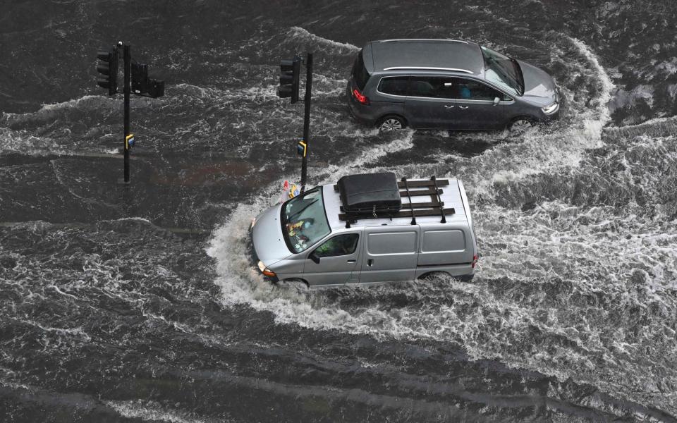
Social media posts showed the capital in rising flood water on Sunday with the London Fire Brigade reporting around 300 calls.
In a tweet, a spokesperson said: "Our Control Officers have now taken around 300 calls to reports of flooding. Avoid driving or walking through flood water. Remember to only call 999 in an emergency."
Meanwhile Wandsworth Police warned drivers to "remember that you're not driving a submarine" and said that those with vehicles should "not enter what could possibly be deep water."
#rain #london
Its raining soooooo much , London is flooding pic.twitter.com/XNWXAhanme— Fawad Haider (@fawad1942) July 25, 2021
London Bridge #Borough #flood #london pic.twitter.com/TmIgk3F03Q
— Jaykhali (@k0909388) July 25, 2021
Avoid A406! Near Walthamstow turnoff. Severe #flooding and stranded cars! #london #londonflood @BBCNews pic.twitter.com/u9bvuuphUx
— Sophie Toumazos (@sophdaws183) July 25, 2021
There’s is quite a lot of flooding in London tonight. If you see deep water, please DO NOT try to get through. Rescuing people uses a lot of resources, and so it’s wiser to apply good judgement and find a different route. #WestRPT pic.twitter.com/pBFFR0ZnJw
— MPSSpecials (@MPSSpecials) July 25, 2021
Met Office meteorologist Steven Keates said parts of the south between south Suffolk and the Isle of Wight could be deluged by 100mm of rain in just a few hours on Sunday evening.
"There's torrential thunderstorms around yet again," he said.
"Into the evening, from Norfolk to Bournemouth we are going to see some pretty lively showers.
"Torrential downpours, thunder and lightning and potentially some hailstones are settling in the south."


Mr Keates said the storms are being caused by a "convergence" of air currents, due to warmth in the earth's surface from the recent heatwave rising into cooler air in the atmosphere.
Temperatures are set to rise in most places again on Monday as the storms clear, with the mercury predicted to reach 26C in London, 25C in Edinburgh, 24C in Cardiff, and 22C in Belfast.
The Met Office has predicted early cloud in some northern and eastern parts which will move up to Scotland, and sunny spells and scattered showers in most places throughout the day.
