
 Yahoo Finance
 Houston area starts cleanup after 23 inches of rain fall in some parts of southeast Texas
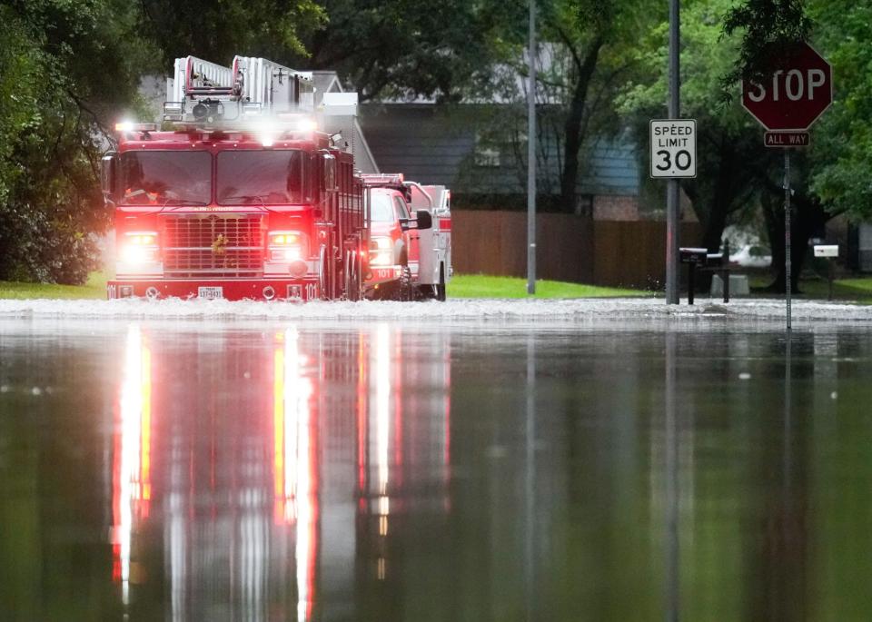
Many schools in the Houston area are closed Monday as the city begins to dry out after getting walloped by torrential rains over the weekend.
Some parts of southeast Texas saw as much as 23 inches of rainfall. Hundreds of people had to be rescued from floods and at least one death was reported, a five-year-old boy who was caught in a car that was swept away by the water.
The relentless rains of the past week and weekend have given way to a period of dry weather as of Monday, but the start of May 2024 is the wettest on record for the city. Areas near Lake Livingston, which is northeast of Houston, received 23 inches of rain. Huntsville, a half hour north of Houston, saw 17 inches. And the town of Conroe, 15 minutes north of Houston, received 7.5 inches.
Sunday’s storms brought up to nine inches of rain to some areas in a span of just six to eight hours, washing out roads and causing rivers to rise.
But the rain will be swapped out for Texas heat this week. Temperatures are expected to top 90 degrees—and with the saturated Earth and humidity, that could take the heat index over 100 degrees.
Forecasters had warned that last summer’s extreme weather was not a one-off meteorological event. A report last month from the Texas State Climatologist at Texas A&M University, Dr. John Nielsen-Gammon, predicted more extreme events this year, including excessive rainfall, noting that clouds produce about 4% more rainfall for every Fahrenheit degree the average temperature increases. That can alter weather patterns and increase the number of dangerous storms.
Last summer, Texas saw temperatures in some areas that were hotter than 99% of the planet, according to some meteorologists. In July, one forecast called for the northern part of the state to reach as high as 112 degrees.
By 2036, the Texas A&M report said, the chances of a 100-degree-plus day will be four times what it was in the 1970s and 1980s.
This story was originally featured on Fortune.com
